X.MO
2024
UX Design. Behaviour Simulation. Optimisation.
Project Duration
4 Months · Master Solo Project
Goal
Exploring how human behavior influences mass mobilization and its potential for simulating strategic refinement
X.MO is a digital platform designed to enhance evacuation planning by optimising the allocation of roadside support for evacuees who may not evacuate via prescribed routes during disasters, targeting at making emergency support accessible to more people.

Context
Due to escalating flood risks in Lincolnshire’s Wash area (Boston, England, United Kingdom) from climate change, local officials have designed multiple evacuation routes to move coastal residents inland during severe floods.
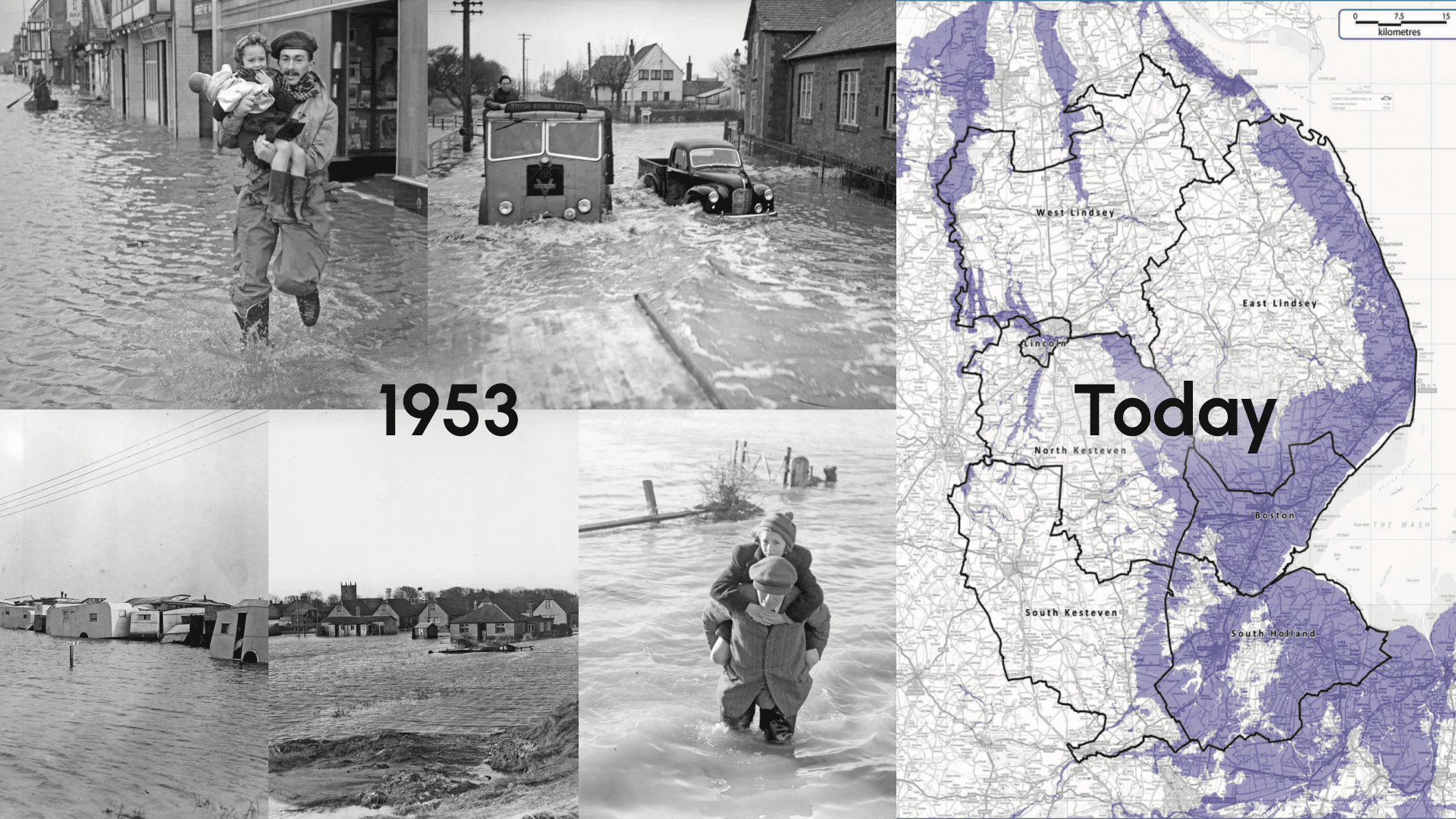
64K
People face risk of coastal flooding
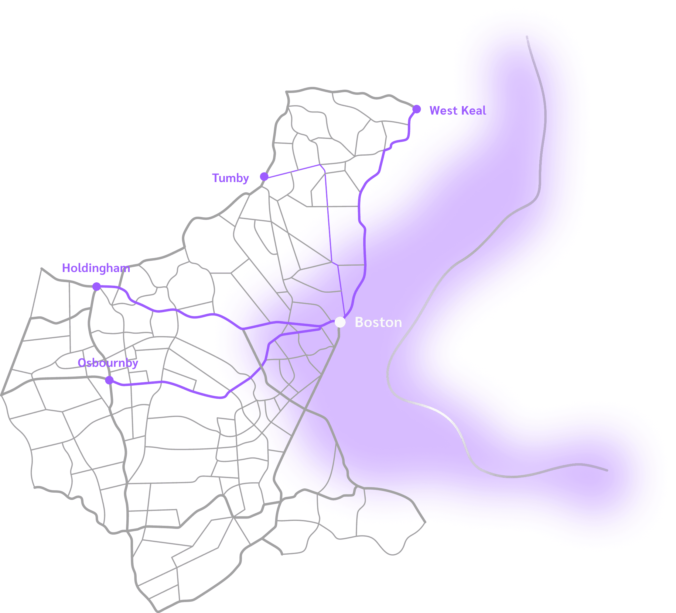
4
Prescribed Evacuation Routes
Boston - West Keal
Boston - Tumby roundabout
Boston - Holdingham roundabout
Boston - Osbournby roundabout
Challenge
However, historical data from similar evacuations shows that about 60% of evacuees do not use these prescribed routes, leading to underutilised roadside assistance that is primarily available along these designated paths. This divergence complicates the delivery of essential support to evacuees.
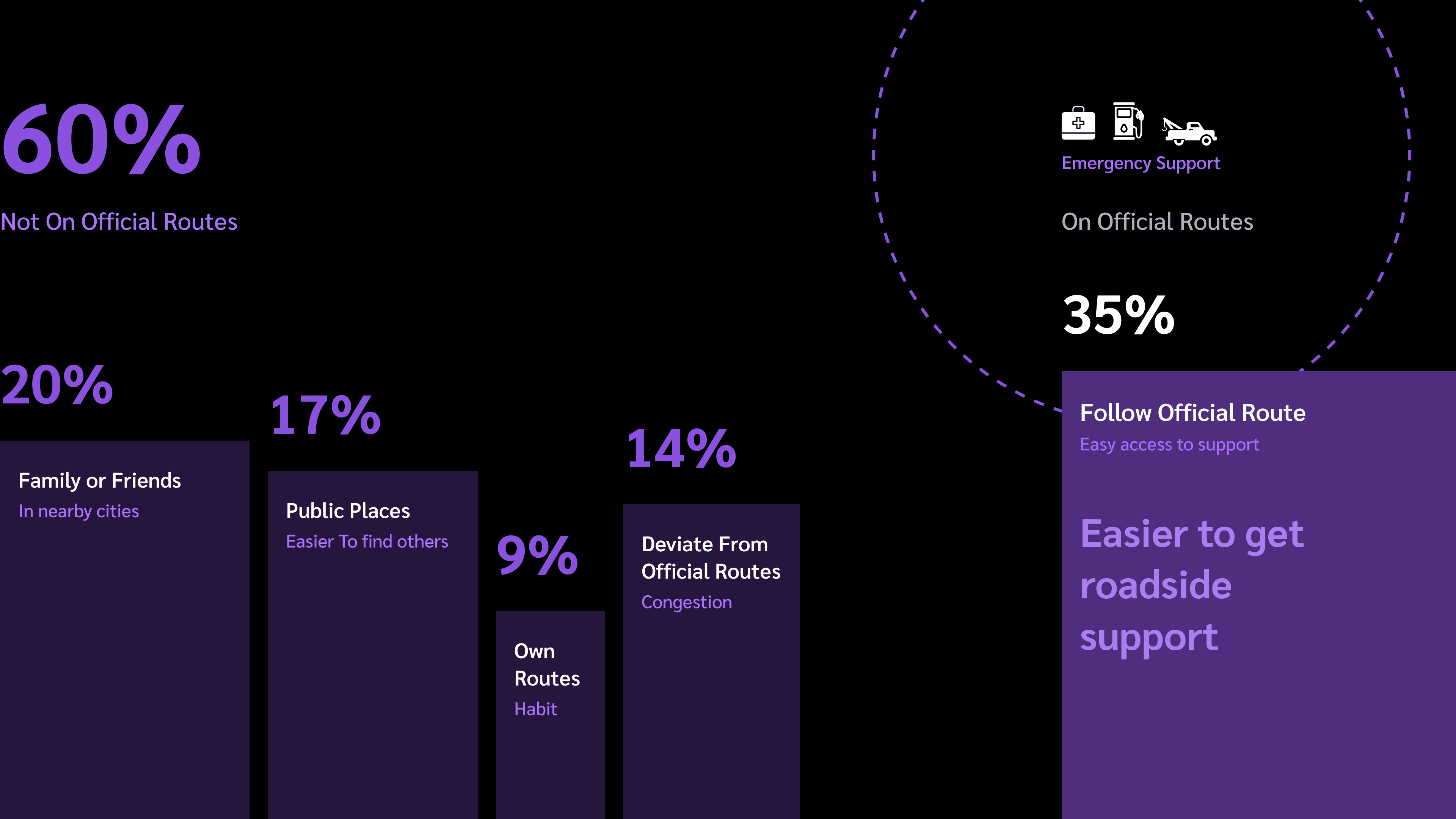
Can we make emergency support allocation more accessible for individuals not using official evacuation routes?
Concept
X.MO is a digital platform that enhances emergency planning by optimising the allocation of roadside support based on evacuees’ route choice behaviours. It includes a mobile app and a simulation platform.
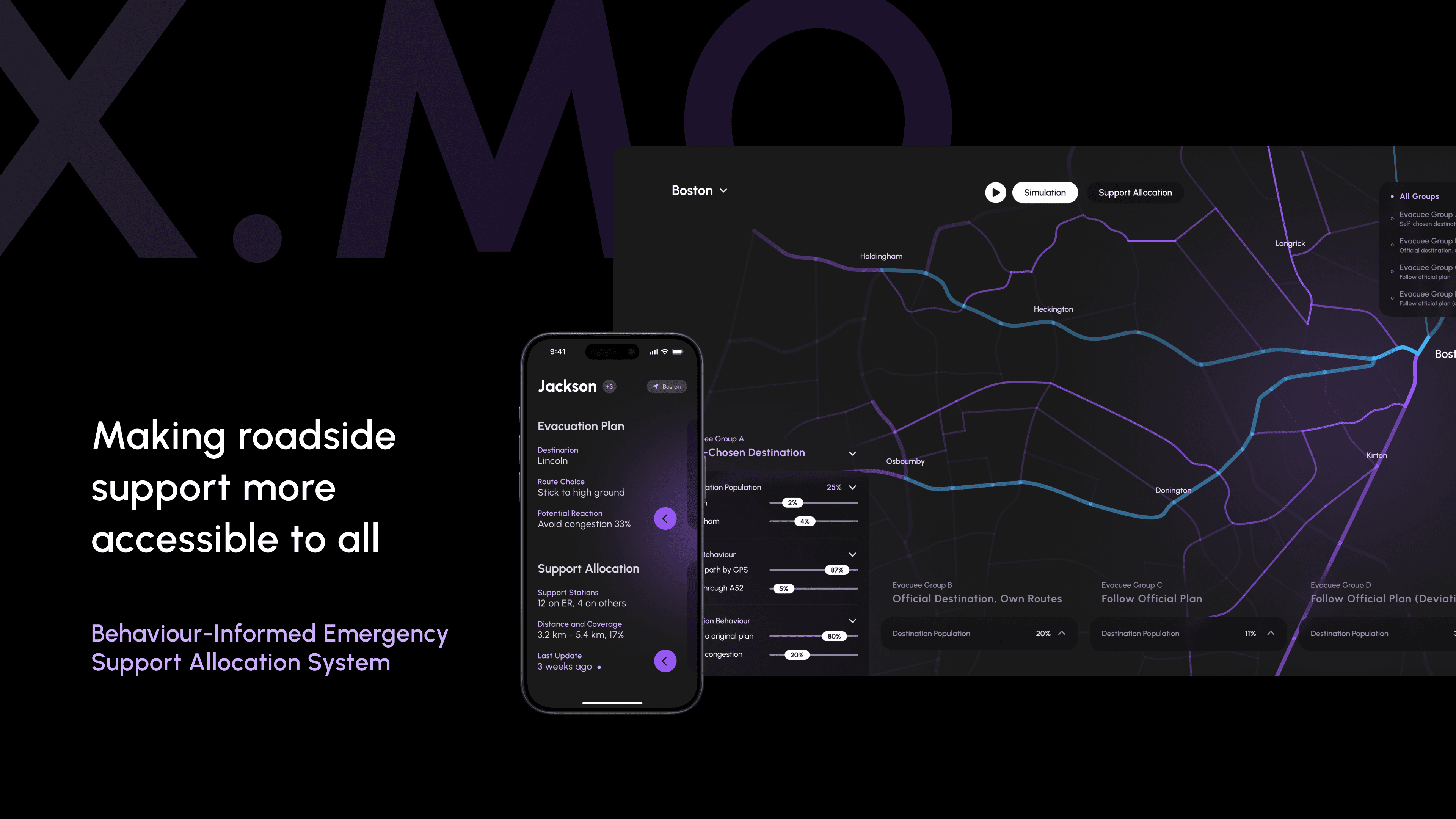
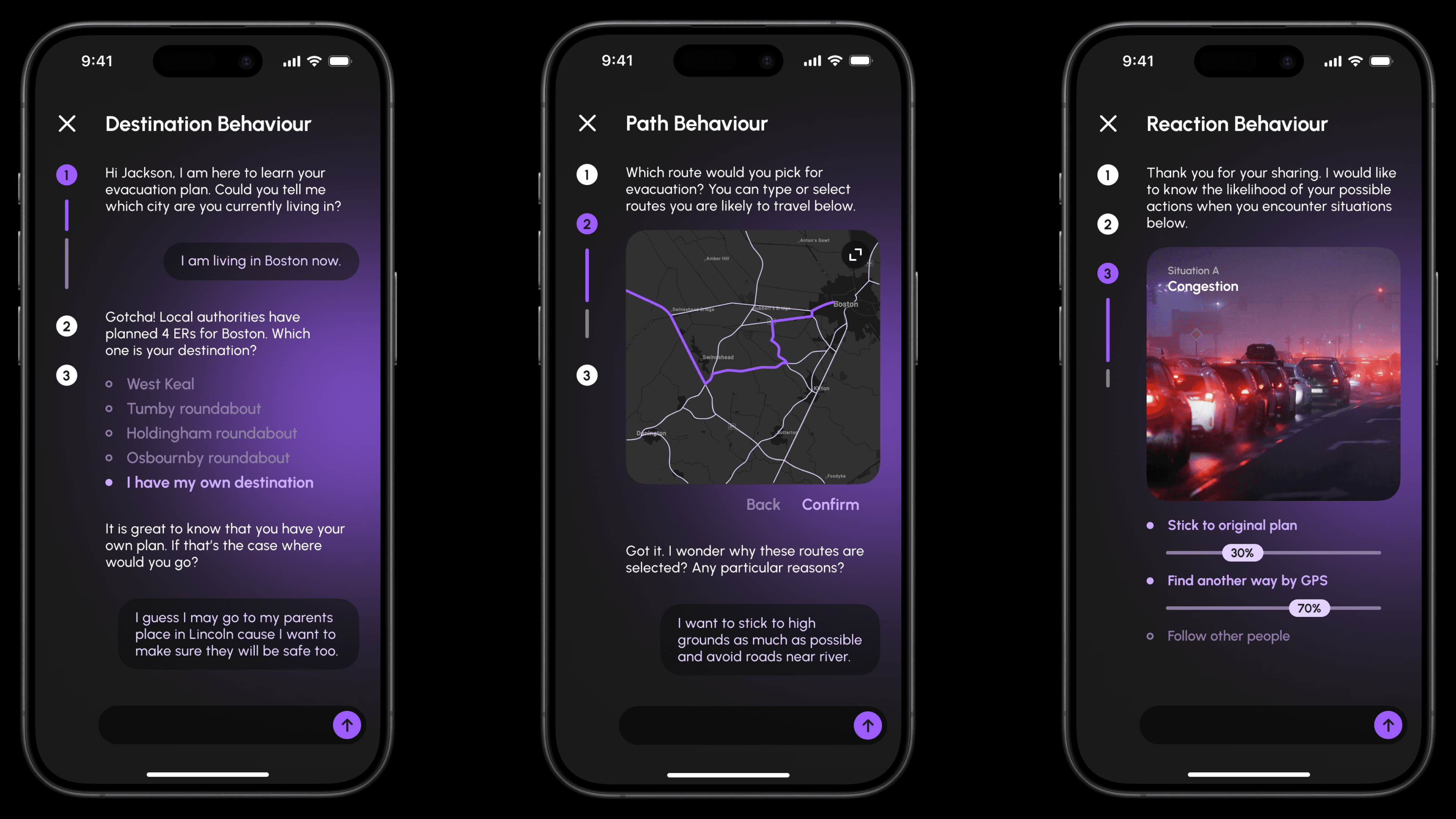
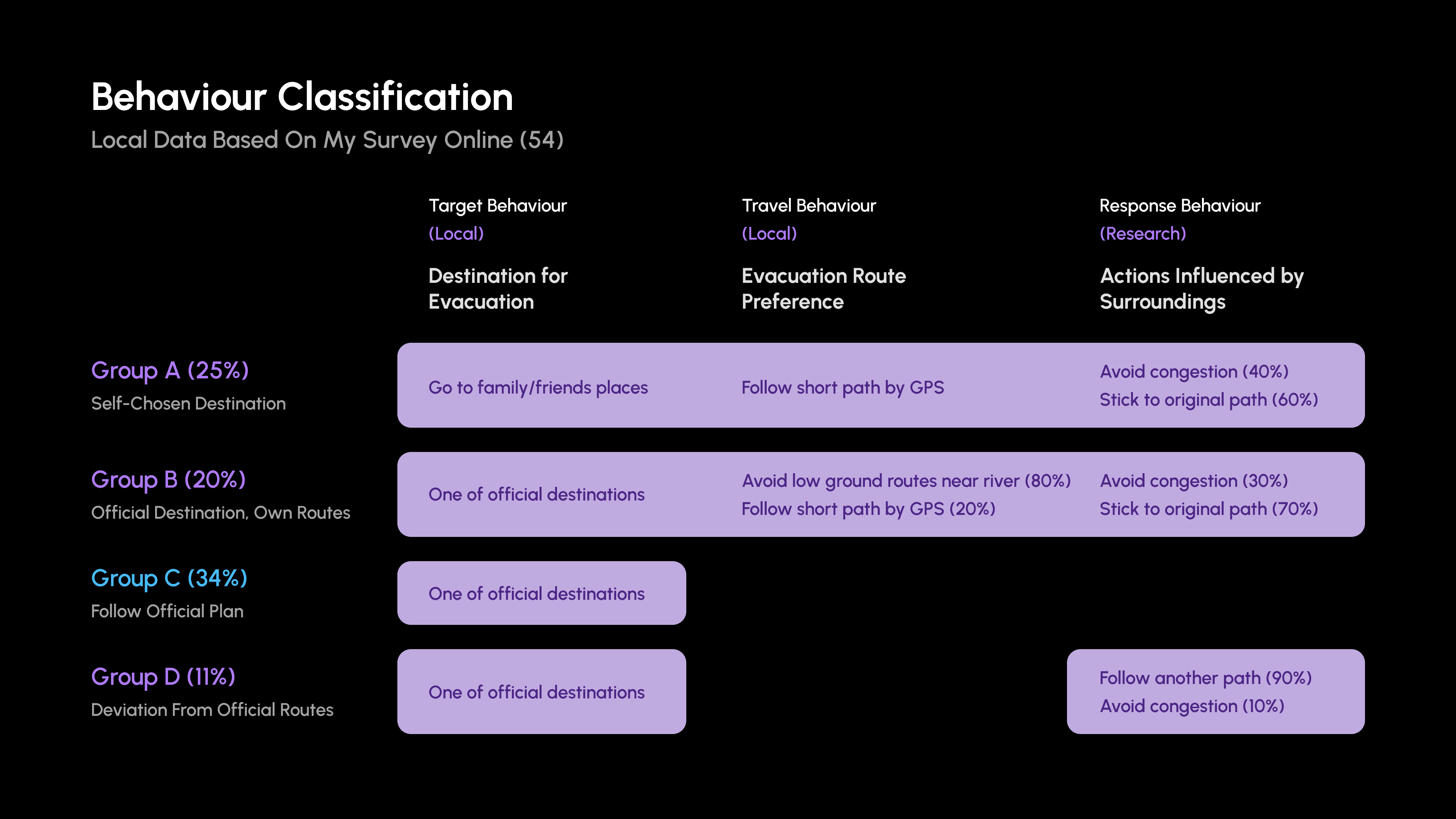
Behaviour Data Collection
The mobile app integrates dialogue-based surveys to gather data on residents’ preferences for evacuation routes and their likely actions during an evacuation.
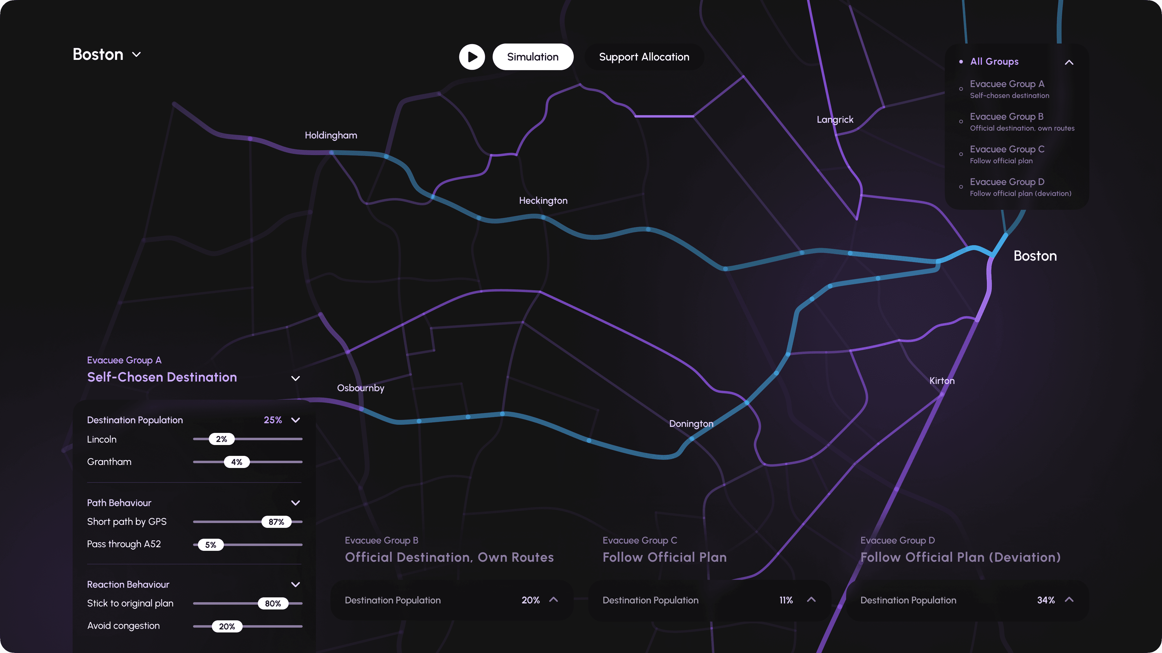
Simulation and Support Allocation
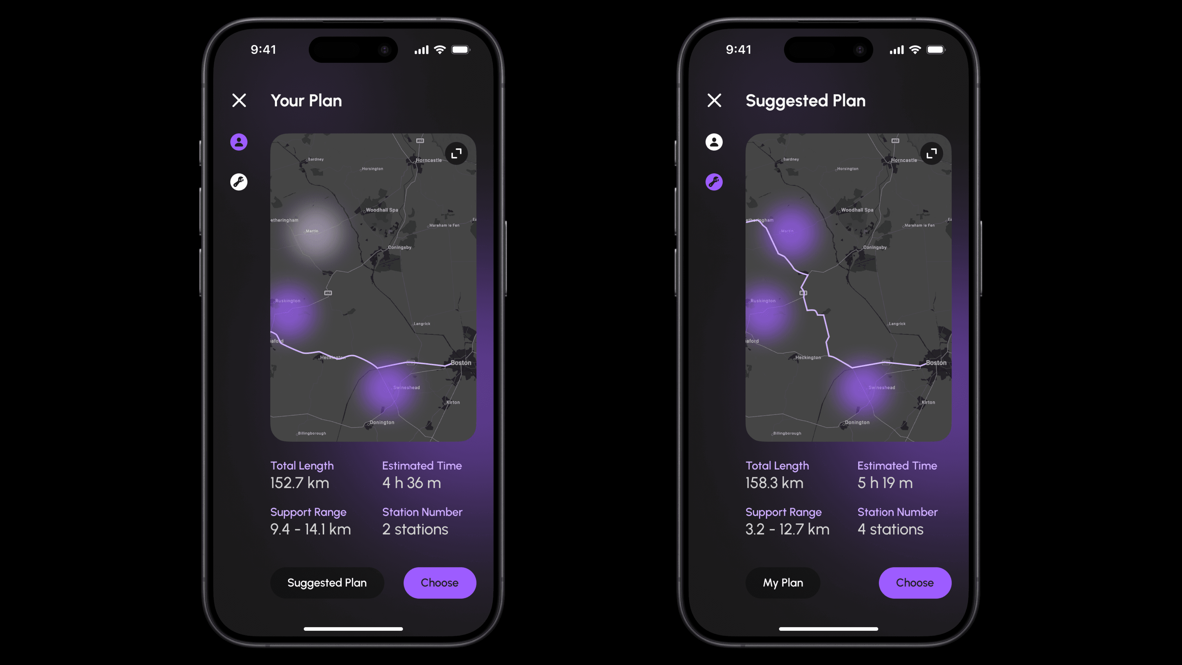
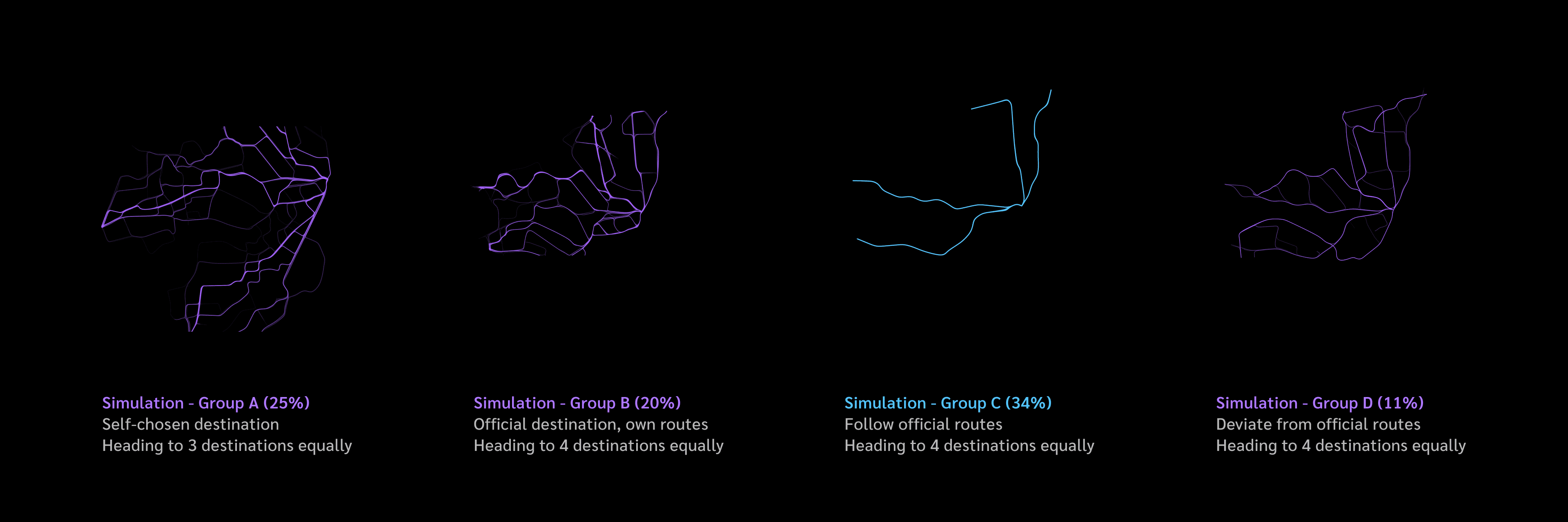
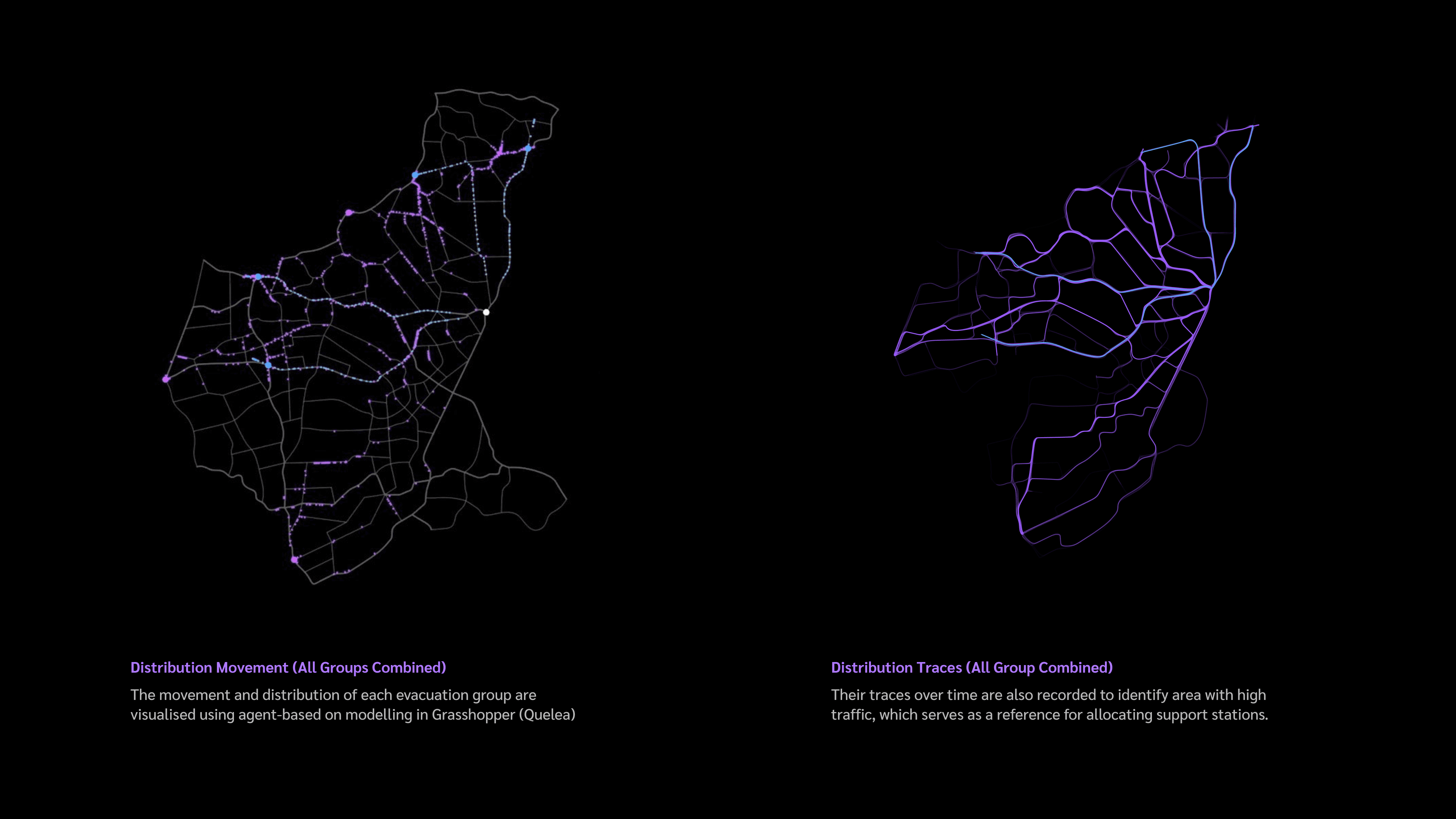
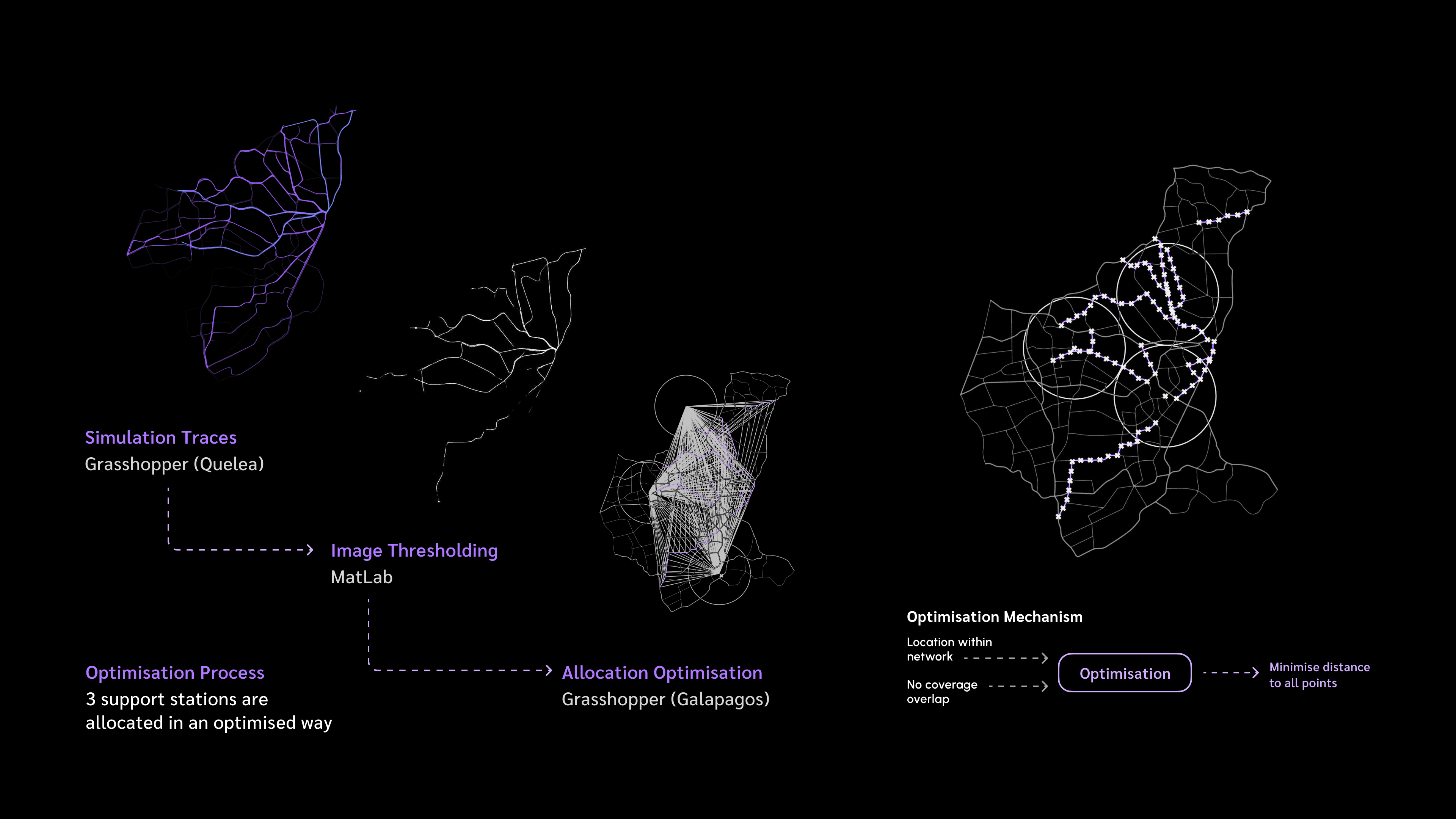
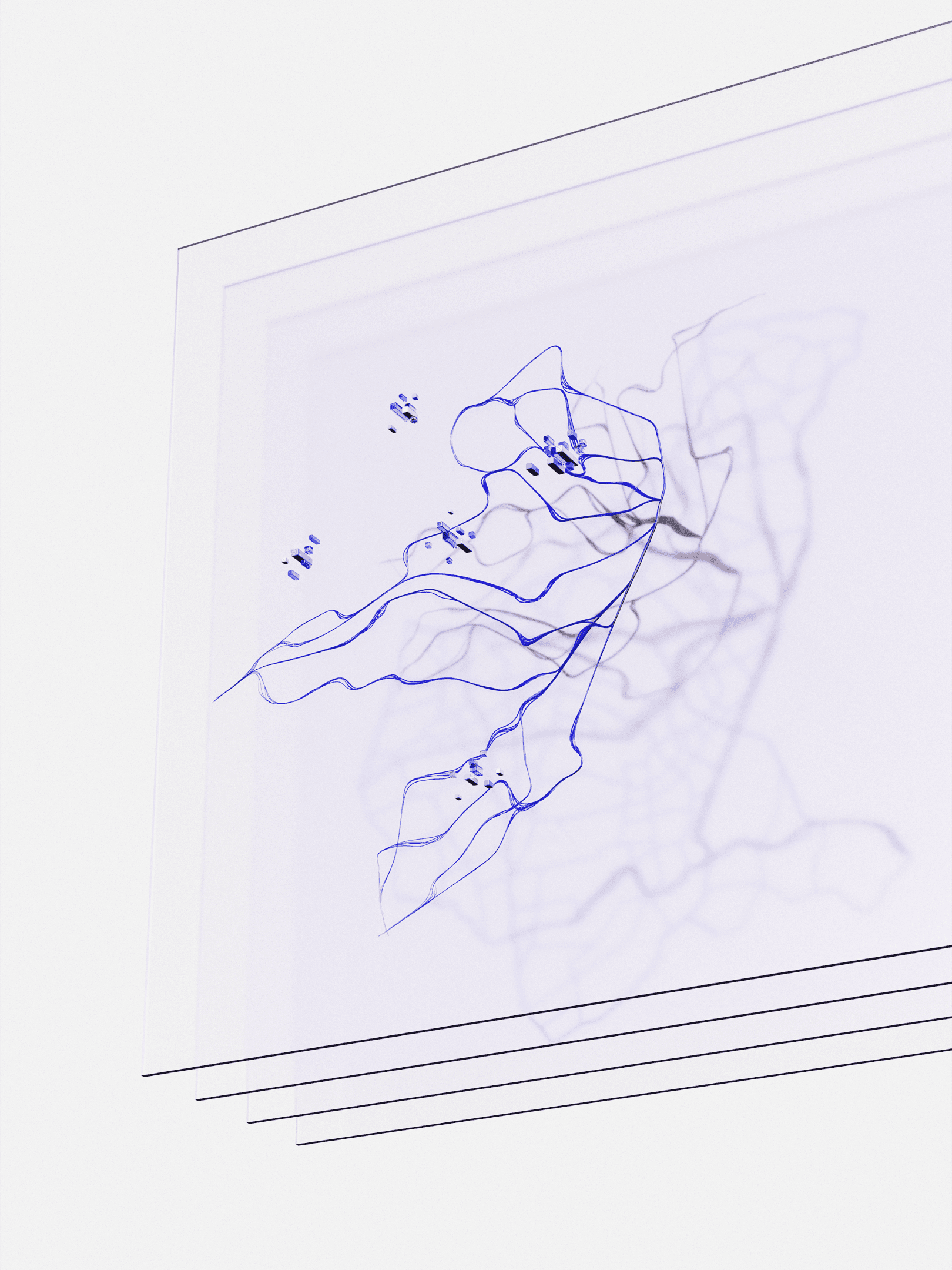
Evacuation behaviour data is input into a simulation system to create distinct groups of evacuees using agent-based modelling. This simulation predicts high traffic areas beyond official routes, helping emergency planners optimise the placement and number of roadside support stations for better coverage.
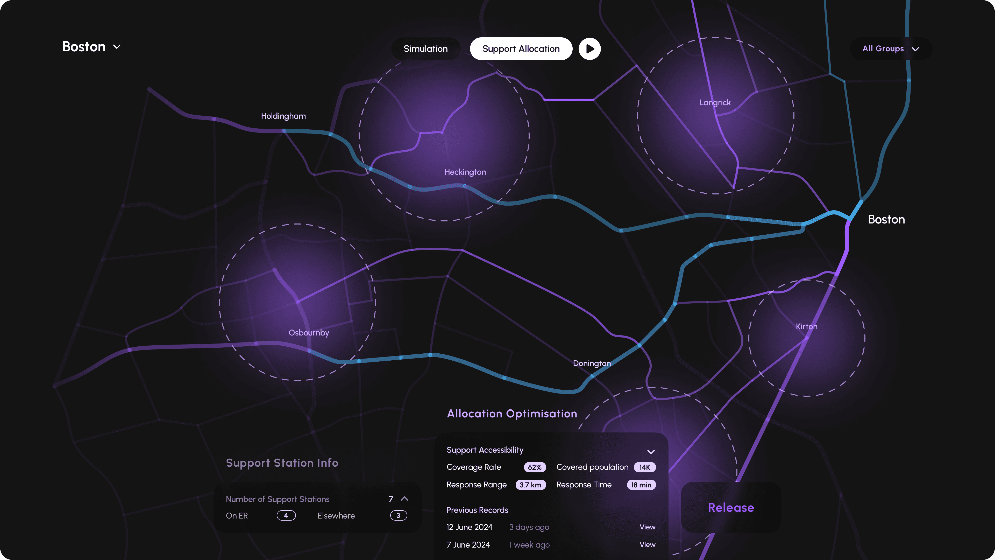
Support Allocation Update
The updates of support stations are then communicated back to residents, keeping them well-informed and prepared.
Process
I experimented with various simulation methods, ultimately focusing on agent-based modelling tools in Grasshopper to accurately represent the behaviours of different evacuee groups. The simulations and their results were consistently shared with emergency planners, garnering positive feedback for offering a new and valuable perspective on support distribution.
X.MO
X.MO is a digital platform designed to enhance evacuation planning by optimising the allocation of roadside support for evacuees who may not evacuate via prescribed routes during disasters, targeting at making emergency support accessible to more people.
2024
UX Design. Behaviour Simulation. Optimisation.
Project Duration
4 Months · Master Solo Project
Goal
Exploring how human behavior influences mass mobilization and its potential for simulating strategic refinement
Context
Due to escalating flood risks in Lincolnshire’s Wash area (Boston, England, United Kingdom) from climate change, local officials have designed multiple evacuation routes to move coastal residents inland during severe floods.
64K
People face risk of coastal flooding
4
Prescribed Evacuation Routes
Boston - West Keal
Boston - Tumby roundabout
Boston - Holdingham roundabout
Boston - Osbournby roundabout
Challenge
However, historical data from similar evacuations shows that about 60% of evacuees do not use these prescribed routes, leading to underutilised roadside assistance that is primarily available along these designated paths. This divergence complicates the delivery of essential support to evacuees.
Can we make emergency support allocation more accessible for individuals not using official evacuation routes?
Concept
X.MO is a digital platform that enhances emergency planning by optimising the allocation of roadside support based on evacuees’ route choice behaviours. It includes a mobile app and a simulation platform.
Behavioural Data Collection
The mobile app integrates dialogue-based surveys to gather data on residents’ preferences for evacuation routes and their likely actions during an evacuation.
Simulation and Support Allocation
Evacuation behaviour data is input into a simulation system to create distinct groups of evacuees using agent-based modelling. This simulation predicts high traffic areas beyond official routes, helping emergency planners optimise the placement and number of roadside support stations for better coverage.
Support Allocation Update
The updates of support stations are then communicated back to residents, keeping them well-informed and prepared.
Process
I experimented with various simulation methods, ultimately focusing on agent-based modelling tools in Grasshopper to accurately represent the behaviours of different evacuee groups. The simulations and their results were consistently shared with emergency planners, garnering positive feedback for offering a new and valuable perspective on support distribution.